
Tunguska 1908 Airburst and Treefall Survey
experimentNo. 0063categoryRides & explorationrecordingpendingdataCC BY 4.0
The fly, enlarged to about 1.4 m, watches the 30 June 1908 Tunguska airburst from a slope above the Southern Swamp, then walks the radially flattened forest with Leonid Kulik's 1927 expedition and flies up to see the butterfly-shaped treefall area from above.
An eight-second loop from the workstation. Full recording pending publication. Follow along for the release.
What the fly saw
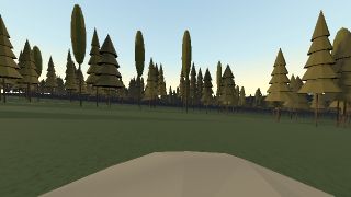
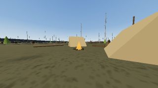
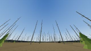
Frames rendered from the fly’s eye camera at four points in the timeline, each with the 32-column retinal input the connectome model receives at that moment.





Timeline
12 steps, with their times in the experiment
- 0:00Taiga, 30 June 1908
Morning above the basin of the Southern Swamp, about 07:14 local time. The fly stands on the north slope among larch and pine.
- 0:10A fireball from the east-southeast
A bright body crosses the sky along the selected trajectory, descending toward the basin.
- 0:16Airburst
The body breaks up several kilometres above the ground. The sky turns white and heat reaches the slopes.
- 0:21The blast wave
The shock reaches the ground almost at once beneath the burst and sweeps outward. Trees fall away from the centre; near the centre many stay standing, stripped of branches.
- 0:31Aftermath
Dust settles over a flattened forest. Smoke rises from scattered fires. (Shock arrival is condensed here.)
- 0:381927: Kulik’s expedition
Nineteen years later Leonid Kulik reaches the basin on his second attempt of the season. The fallen trunks are bare and grey; young trees grow between them.
- 0:50Camp beside the Southern Swamp
A tent camp by the Churgim stream. Camp 13 was pitched at the Churgim’s mouth on 30 May 1927; the huts near Mount Stoykovich followed in 1928–30.
- 1:00Survey along the fallen trunks
The fly walks along a fallen trunk toward the centre. Every trunk points away from it: roots toward the basin, tops outward.
- 1:24The telegraph forest
Close to the centre, dead trees still stand without branches, like telegraph poles.
- 1:38Radial pattern from the hilltop
From a hill north-east of the basin the trunks on every slope point outward, as Kulik found while walking the surrounding hilltops.
- 1:50The butterfly from above
The fly rises above the forest. From high above, the flattened area forms a butterfly-shaped region of about 2,150 square kilometres.
- 2:08Treefall catalogue overlay
Trial areas carry one mean fall direction each, as in the Fast and Longo catalogues. These arrows are generated from the published description, not the catalogue values.
Setup
- Twelve seekable stages over 140 seconds: the taiga at about 07:14 local time on 30 June 1908, the fireball, the airburst, the blast wave and aftermath, then Kulik's 1927 expedition, its camp beside the Southern Swamp, a walk along the fallen trunks, the standing "telegraph forest", the radial pattern seen from a hilltop and the treefall area from above.
- One scene unit equals one metre, centred on Fast's epicentre (60.886° N, 101.894° E), over 100 km of modeled terrain with 14,293 instanced larch, pine and birch trees.
- Controls select one of four published trajectory azimuths (99°, 110°, 115° or 127° from north; default 115°, Fast 1967) and a burst height from 5 to 10.5 km (default 8.5 km); the body descends at 30°, after Longo et al. (2005).
- Fallen trees are 60% uprooted and 40% snapped; within about 2.6 km many stay standing without branches, and by 1927 the trunks are bare with young trees growing between them.
- Two additional flies represent Kulik and an expedition member in 1927. Seven cameras, including first person, a view toward the burst, a 40 km high oblique and a view from above with a display-only survey overlay of the outline, trajectories and sites.
Measurement
- Retinal-only input: during live playback the canonical 32-column eye image reaches the fixed connectome model, and measured spikes drive the neural display; weights are not updated.
- The fireball, sky flash, dust and falling trees are scene geometry and lighting, so they reach the eye image; the survey overlay and labels never do.
- The airburst timeline, the fly's walking and flight, and the expedition flies are pre-programmed; measured spikes do not move the fly.
Limitations
- No energy, overpressure or wind field is simulated; shock arrival is stretched in time for legibility, and published energy estimates (3–5 Mt to 10–20 Mt) are context only.
- No digital treefall catalogue is openly downloadable, so fall directions are generated radially from the published description around Longo et al.'s 110° axis; the overlay's trial-area arrows are labelled as generated, not catalogue values.
- The butterfly outline is an approximate digitization of Longo et al. (2005), scaled to the published area of 2,150 km² (Longo 2007).
- The terrain is a modeled basin after Krinov (1949), not an elevation model; streams, the 1908 viewpoint and the 1927 camp are placed approximately, and other site bearings come from volunteer OpenStreetMap data.
- Tree heights are an assumption, and at this scale the eye's fixed sensory fog limits the retina to roughly the nearest 100–150 m, so distant terrain is seen only in viewport cameras.
Sources
- Giuseppe Longo, The Tunguska event (Comet/Asteroid Impacts and Human Society, ch. 18, 2007)
- Longo et al. (2005), new unified catalogue and map of the 1908 tree fall: abstract and map
- E. L. Krinov, The Tunguska Meteorite (1949): the 1927 expedition (in Russian)
- Hydrocode simulations of asteroid airbursts and constraints for Tunguska (Robertson & Mathias, Icarus, 2019)
- Misunderstandings about the Tunguska event, shock wave physics, and airbursts (Boslough & Bruno, Scientific Reports, 2025)
- Tunguska event, Wikipedia


